Visual-Inertial Localization for UAVs in Agricultural Environments
At TIH, IIT Bombay, I worked on visual-inertial localization for UAVs in GNSS-denied agricultural environments. I evaluated the feedback-based visual-inertial system (FVIS) described in the published work for UAV pose estimation using visual and IMU measurements.
I developed a Gazebo simulation using an Iris quadcopter equipped with a downward-facing Intel RealSense depth camera. The system was evaluated across structured and unstructured agricultural environments at flight altitudes of 3.5 m, 10 m, and 20 m.
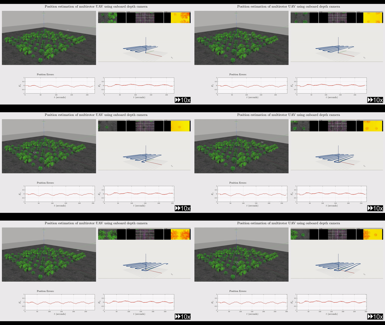
Simulation Environments
The system was evaluated in three environments with different levels of visual structure.
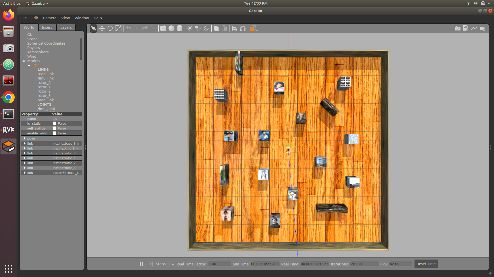
Structured environment with rich and diverse visual features
Simulation Video
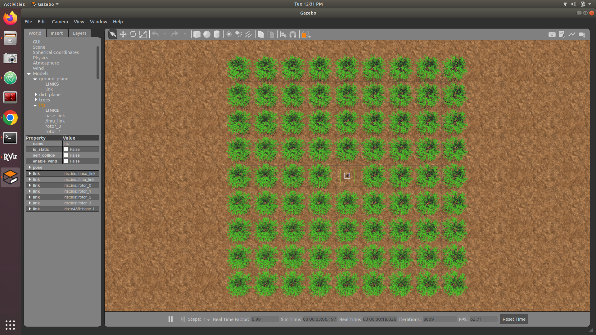
Structured agricultural environment with regular feature arrangement
Simulation Video
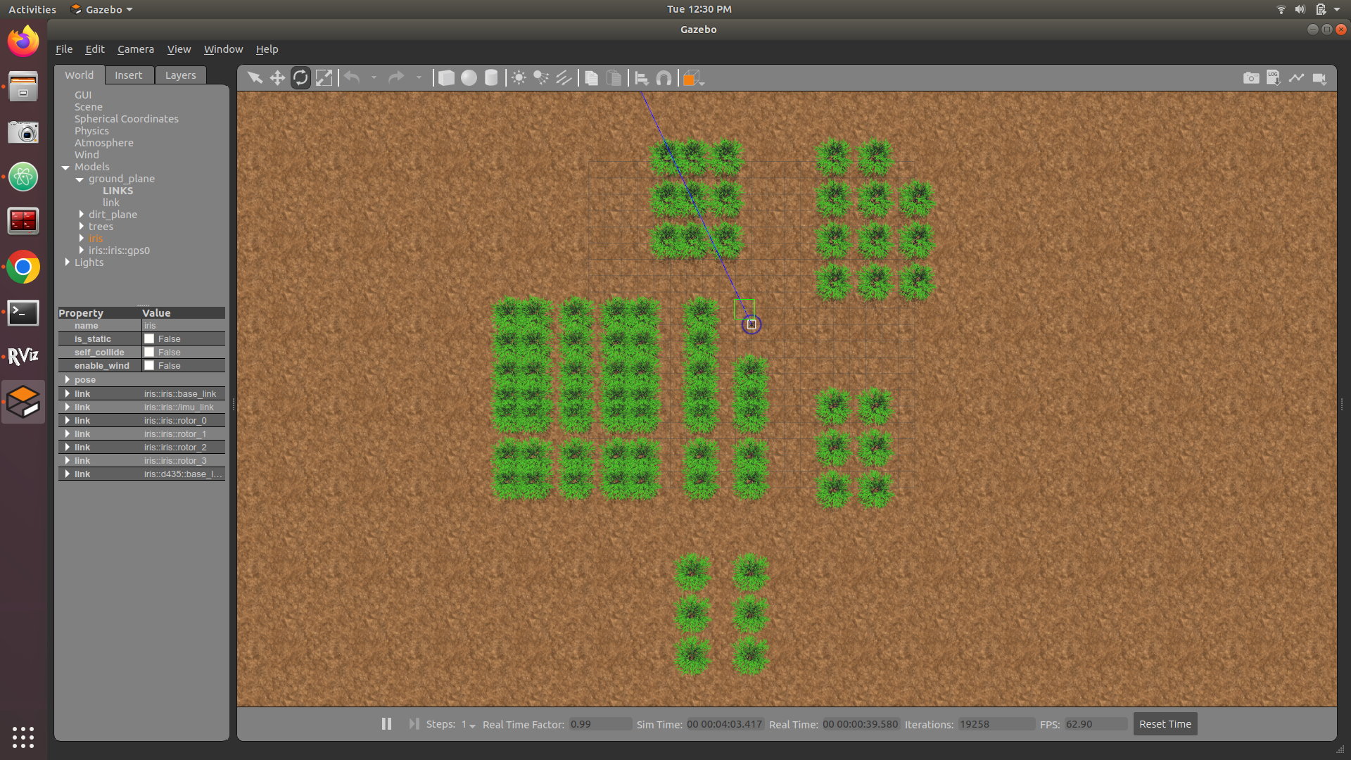
Unstructured environment with randomly distributed features
Simulation Video
For each environment, the estimated position and velocity were compared with simulation ground truth at flight altitudes of 3.5 m, 10 m, and 20 m.
Localization Results
Manhattan World
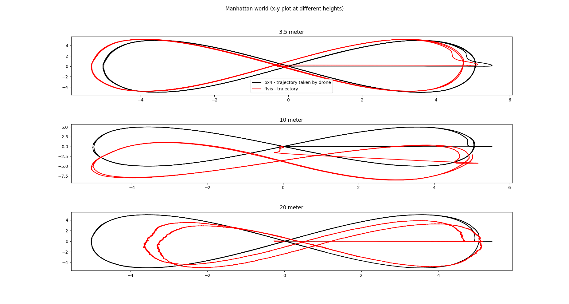
Estimated and ground-truth position at 3.5 m, 10 m, and 20 m
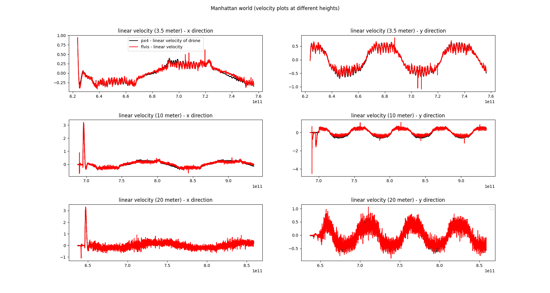
Estimated and ground-truth velocity at 3.5 m, 10 m, and 20 m
Farm Grid World
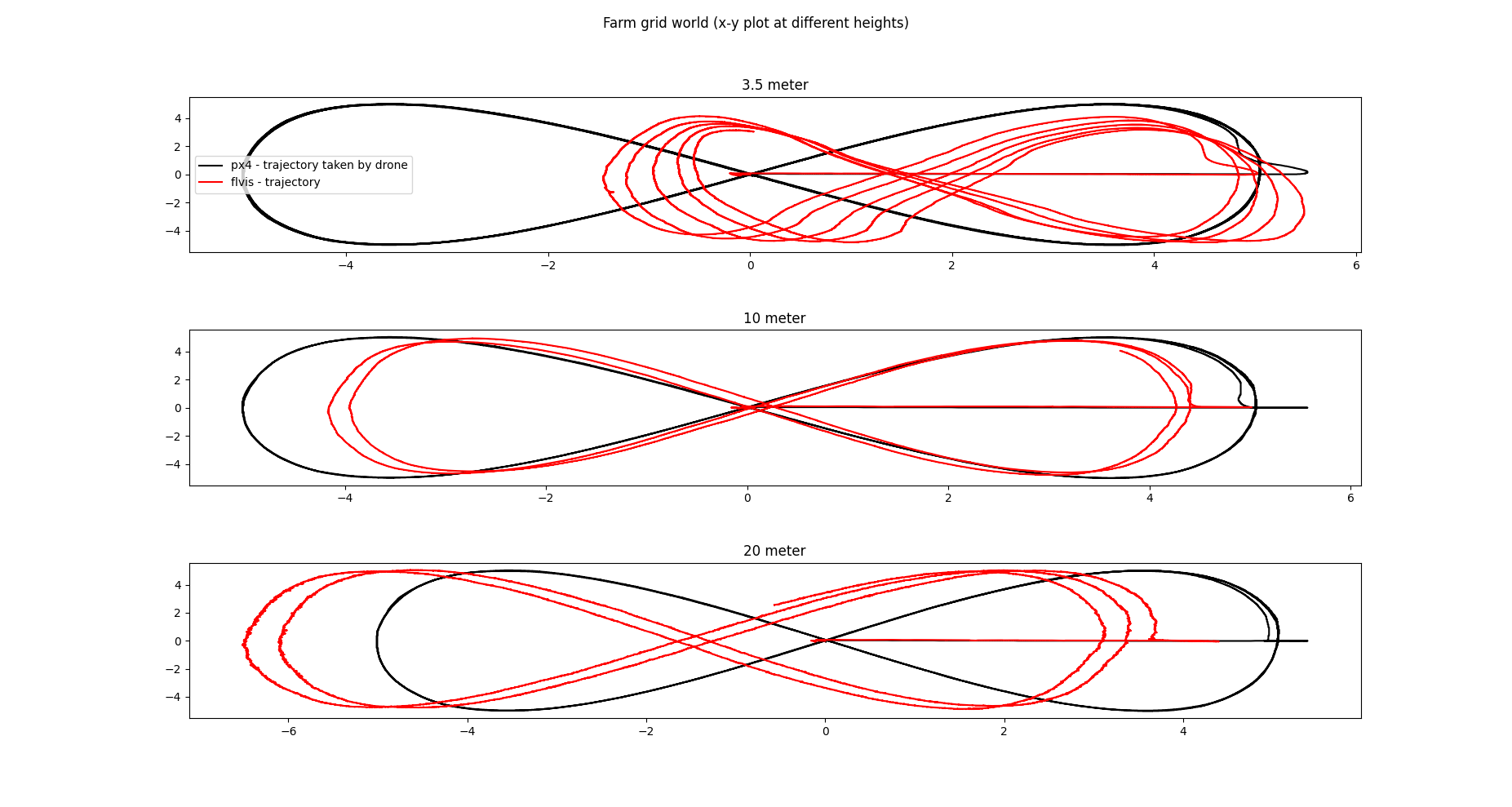
Estimated and ground-truth position at 3.5 m, 10 m, and 20 m
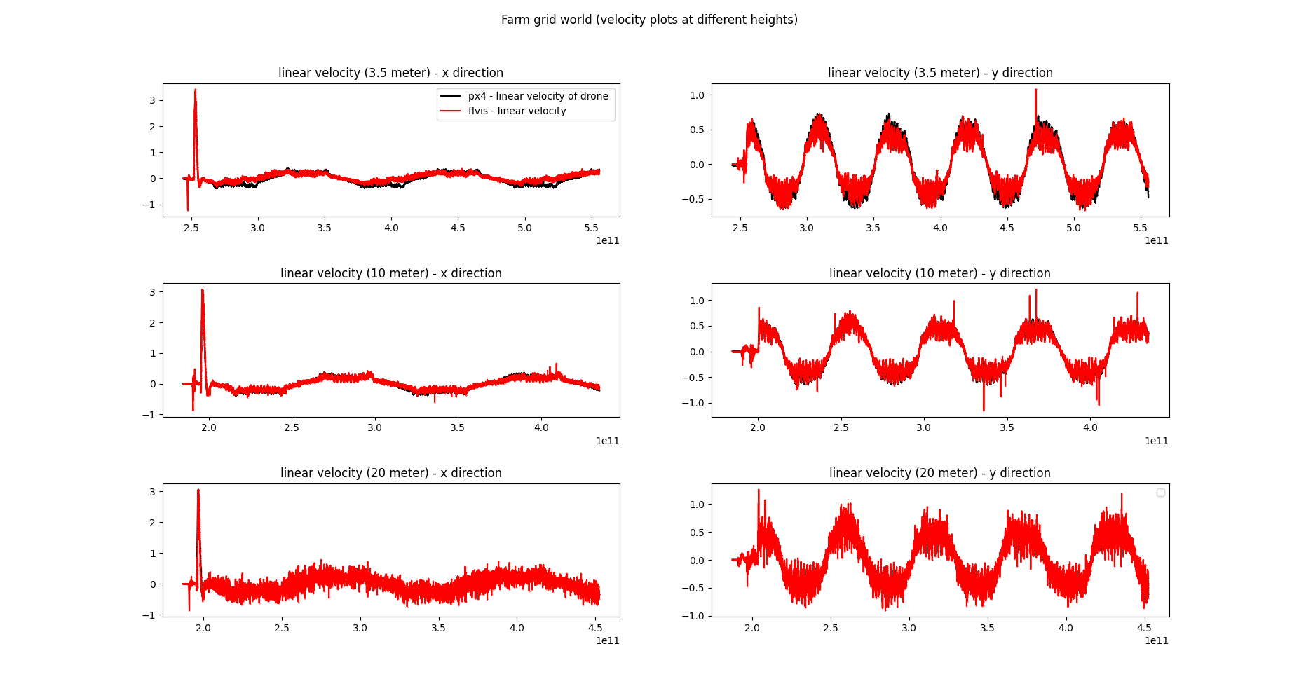
Estimated and ground-truth velocity at 3.5 m, 10 m, and 20 m
Farm Random Arrangement
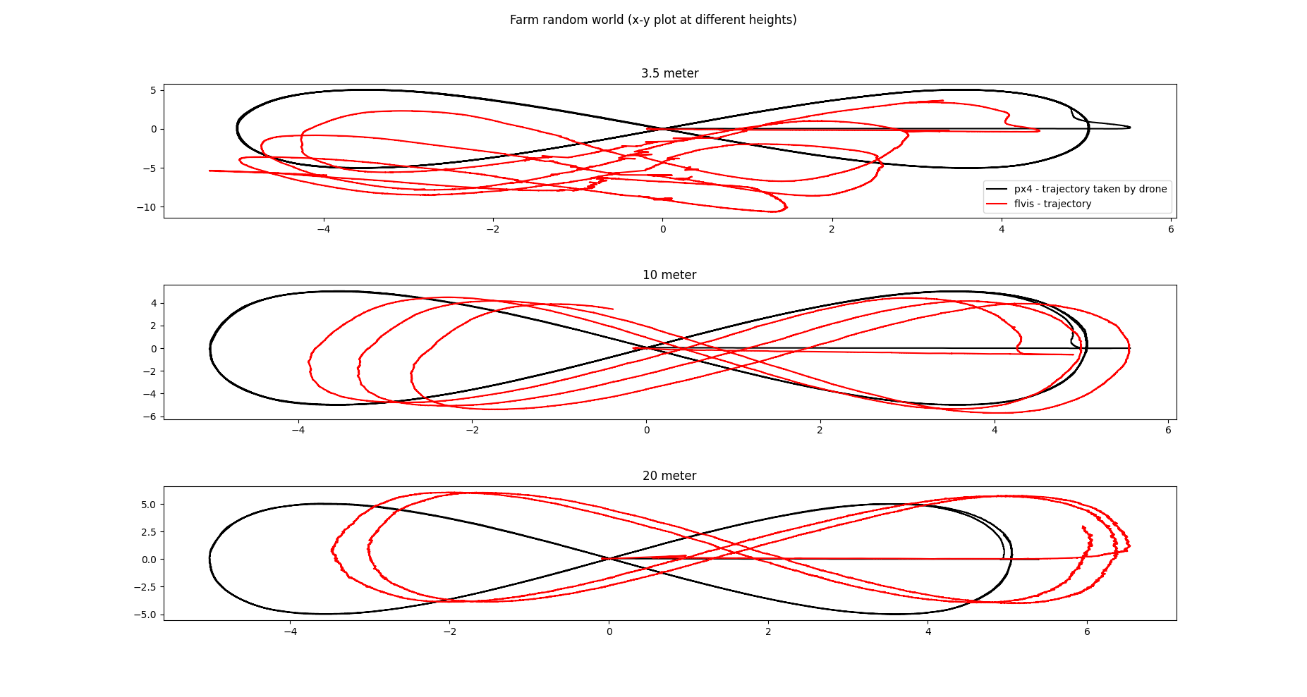
Estimated and ground-truth position at 3.5 m, 10 m, and 20 m
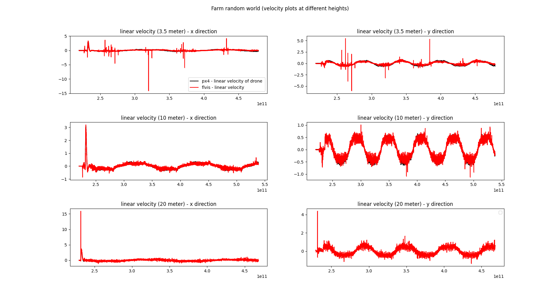
Estimated and ground-truth velocity at 3.5 m, 10 m, and 20 m

Authors
Robotics Engineer & Researcher
Robotics engineer and researcher with 10+ years of experience specializing in robotics and computer vision.